

Geospatial Data Analyst In Chennai
Mapping Intelligence: The Power of a Geospatial Data Analyst
In today’s interconnected world, location is more than just a point on a map—it’s actionable intelligence. Whether you're tracking climate change, optimizing delivery routes, planning smart cities, or monitoring land use, geospatial data plays a pivotal role. At the center of this spatial revolution is the Geospatial Data Analyst—a data expert who interprets the ‘where’ to improve the ‘how’.
At Sharaa Group, we recognize the rising demand for geospatial expertise across sectors like agriculture, logistics, defense, environment, and urban development. Our mission is to connect innovative organizations with highly skilled Geospatial Data Analysts in Chennai and across India, enabling them to unlock the full potential of spatial data.
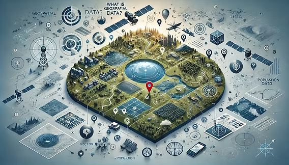
What Is Geospatial Data Analysis?
Geospatial analysis involves collecting, processing, and interpreting data that has a geographic or spatial component. This data is often visualized on maps and used to uncover patterns, trends, and relationships tied to location.
Examples of geospatial data include:
-
Satellite imagery
-
GPS coordinates
-
Remote sensing data
-
Survey and census data
-
Real-time IoT location feeds
Who Is a Geospatial Data Analyst?
A Geospatial Data Analyst is a professional who:
-
Collects spatial data from various sources (satellites, drones, sensors)
-
Cleans and preprocesses large datasets
-
Uses Geographic Information Systems (GIS) to analyze and visualize data
-
Applies statistical and machine learning techniques to detect spatial patterns
-
Provides actionable insights to inform decision-making
These professionals work at the intersection of geography, data science, and computer programming, offering both technical and domain expertise.
Key Tools & Technologies
Geospatial Data Analysts work with a powerful tech stack, including:
-
GIS Software: ArcGIS, QGIS, GRASS GIS
-
Programming Languages: Python (GeoPandas, PyProj), R (sf, raster), SQL
-
Remote Sensing Tools: ERDAS Imagine, Google Earth Engine
-
Databases: PostGIS, MongoDB with geospatial indexing
-
Visualization Platforms: Mapbox, Leaflet, Tableau
Real-World Applications
1. Urban Planning & Smart Cities
Geospatial analysts help city planners design smarter infrastructure, optimize public transport routes, and manage utilities through spatial modeling.
2. Agriculture & Precision Farming
By analyzing soil health, crop patterns, and weather data, analysts guide farmers in optimizing yield and resource usage.
3. Logistics & Supply Chain Optimization
From route planning to last-mile delivery, location intelligence helps reduce costs and improve efficiency.
4. Disaster Management & Environmental Monitoring
During floods, earthquakes, or pandemics, geospatial data enables real-time tracking, risk analysis, and response planning.
5. Telecommunications
Telecom companies use geospatial data to plan tower placements, assess signal coverage, and monitor service demand by location.
Why Geospatial Talent Is Crucial Now
As industries increasingly rely on location-aware technologies—from drones and satellites to IoT and 5G—the demand for geospatial expertise is soaring. In India, particularly in tech-forward cities like Chennai, opportunities for Geospatial Data Analysts are growing in:
-
Government planning departments
-
Environmental research institutions
-
Urban development agencies
-
Agritech and logistics startups
-
Defense and security sectors
Sharaa Group is at the forefront of recruiting for this in-demand role, providing companies with data professionals skilled in spatial analysis, mapping technologies, and strategic geolocation insights.
Conclusion: Empowering Decisions with Location Intelligence
The world is rapidly shifting toward location-aware systems—from smart cities and sustainable agriculture to climate monitoring and real-time logistics. At the core of this transformation is the Geospatial Data Analyst, turning complex spatial data into clear, actionable intelligence.
